Texas Wing Provides Air Support for Texas State Agencies
Product Information
 DENTON, Texas – Civil Air Patrol’s Texas Wing members continue to fly damage assessment photography missions over areas flooded by recent rains. Texas Wing aircrews have flown 56 missions and have taken over 8,400 images since March 11.
Major areas of concern according to Lt. Col. Rick Woolfolk, incident commander for Texas Wing, are the counties of Jasper, Marion, Newton and Orange and emphasis on areas of economic impact to include Interstate 10, an electrical power plant and railroad bridges.
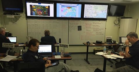
The State Operation Center uses the imagery for state response and mitigation planning by Texas Division Emergency Management, Texas Commission on Environmental Quality and Texas Department of Transportation. “CAP has done a great job of day-by-day documentation of changing conditions at key structures,” said Dr. Gordan Wells, program manager, Center for Space Research at UT Austin.
Civil Air Patrol requested the Federal Aviation Administration imposed flight restrictions in the impact areas. Numerous non-government aircraft have been observed and are not in communication with an Air Traffic Control facility causing CAP aircraft to deviate from the intended flight route. A temporary flight restriction was issued by the FAA restricting non-essential aircraft, to include unmanned aircraft systems in the impact areas.
“CAP aircraft are flying at 1,000 feet and have encountered everything from helicopters to ultralights leading to a potential hazardous situation,” said Maj. Steve Robertson, southwest region director of emergency services.
Texas Wing expects photography missions to continue through Mar 23 and possibly longer.